Understanding how wind behaves is not just a scientific pursuit but a practical necessity across construction, aviation, energy, and environmental monitoring. Every shift in wind speed or direction can influence decisions that affect public safety, structural performance, and operational planning. Measuring these changes accurately begins with understanding the anemometer. This instrument, often seen spinning on rooftops or mounted on weather towers, plays a direct role in turning invisible air movement into clear, measurable data. It links natural forces to real-time decisions and supports systems that depend on safe, timely, and well-informed responses.
What Is Wind, Scientifically?
Wind is the movement of air across the Earth’s surface, driven by differences in atmospheric pressure. Air naturally flows from areas of high pressure to areas of low pressure, creating wind currents. These movements are not random. They are shaped by a mix of temperature patterns, the rotation of the Earth, and the shape of the land below.
What Causes Air Pressure Differences?
When the sun heats the Earth unevenly, warmer areas cause the air to rise, and cooler areas cause it to sink. This difference in air movement changes the local pressure. Areas where warm air rises tend to have low pressure. Regions where cool air sinks tend to have high pressure. As air moves between these zones, wind forms. The strength of that movement depends on how steep the pressure difference is across a given distance.
Other Forces That Shape Wind
The Earth’s rotation creates an effect known as the Coriolis force. This causes wind to curve as it travels instead of moving in a straight line. Terrain also plays a part. Mountains, valleys, and buildings can speed up, slow down, or redirect wind patterns. The final result is a mix of forces constantly shaping wind around us.
Types of Wind
Surface winds move across the lower levels of the atmosphere and are most commonly measured in weather reports. Higher up, powerful air currents called jet streams flow around the globe. These high-altitude winds influence weather systems and long-range forecasts.
Key Wind Parameters
Wind Speed
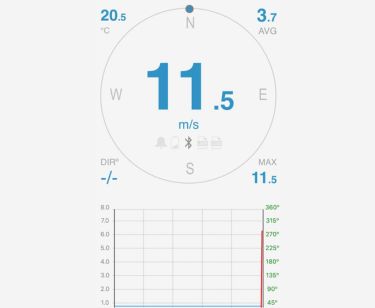
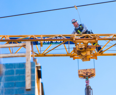
Wind speed shows how fast air is moving at a specific location. It is usually recorded in meters per second, kilometers per hour, or knots. This value plays a central role in wind monitoring. On construction sites, crane operators rely on accurate speed readings to make safe lifting decisions. In aviation, wind speed affects takeoff, landing, and in-flight control. It also guides farmers, power producers, and weather forecasters.
Wind Direction
Wind direction tells us where the wind is coming from, based on degrees from true north. This measurement helps pilots plan safe routes and landings. On farms, it guides spraying and planting decisions. In marine environments, wind direction affects wave formation, docking, and offshore safety. Meteorologists also rely on it to model the movement of weather systems across regions.
Gusts
Gusts are brief but strong increases in wind speed that can appear without warning. Although they may not last long, they carry significant force. Cranes, temporary structures, and outdoor equipment are often affected when gusts occur. For pilots, a strong gust during takeoff or landing requires quick response. These short spikes are also useful in storm analysis and warning systems.
Turbulence
Turbulence happens when wind shifts suddenly or flows in irregular patterns. It can cause shaking during flights or stress on wind turbines and tall buildings. Forecasting models use turbulence data to improve flight safety, building designs, and energy system planning. Turbulent zones are closely monitored at airports and construction zones.
Why These Values Matter
Wind data is used every day in fields like weather forecasting, aviation, construction, and structural design. Each parameter adds a layer of understanding. Speed shows power. Direction reveals flow. Gusts signal danger. Turbulence hints at instability. When combined, these readings create a fuller picture that helps protect lives, guide safe decisions, and support long-term planning.
How Anemometers Capture Wind Data
Understanding anemometers starts with the basic idea of translating moving air into numbers. Every type of anemometer uses a different method to sense motion, convert it into signals, and produce readable values. These measurements help track patterns, detect changes, and support reliable decision-making across weather, engineering, and safety applications. The anemometer has changed modern weather forecasting by giving dependable information that people now use to plan, respond, and stay prepared.
Cup and Vane Anemometers
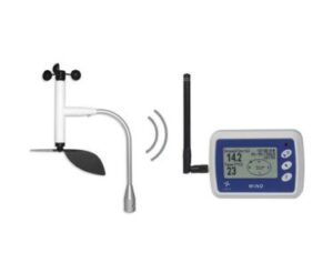
The most familiar design uses three or four cups mounted on horizontal arms that spin when wind passes through. The faster the wind blows, the faster the arms rotate. A sensor inside converts the rotation rate into wind speed. A wind vane can be added alongside the cups to determine wind direction. This type is simple, reliable, and widely used in outdoor environments, including farms and weather stations.
Ultrasonic Anemometers
Instead of moving parts, ultrasonic anemometers use sound. Two or more sensors face each other across a small gap. When wind flows between them, it affects the time it takes for sound waves to travel in each direction. The system compares these time shifts to calculate wind speed and direction. This method offers fast, accurate results and works well in high-tech installations like airports and research sites.
Hot-Wire Anemometers
A heated wire placed in the wind path forms the core of this sensor. As wind flows over the wire, it cools down, causing a drop in voltage. This drop is directly related to wind speed. Though sensitive and precise, hot-wire models are usually kept indoors or in labs due to their delicate build.
Why Placement and Calibration Matter
No matter the type of anemometer, where and how it is installed affects the quality of its data. Obstructions such as buildings, trees, or uneven surfaces can distort readings. Calibration must be done regularly to maintain accuracy, especially in harsh weather or changing environments. A well-placed and properly maintained anemometer offers consistent, meaningful insights that help protect lives and property.
Why Accurate Wind Measurement Matters
Wind data plays a major role in shaping weather forecasts. Measurements from anemometers feed into global and regional models that simulate atmospheric behavior. These models use wind speed and direction to estimate storm development, pressure systems, and temperature changes. Without accurate wind input, forecasts can shift off course, reducing their usefulness for public planning and emergency response.
Safety Across Critical Operations
Many sectors depend on accurate wind information to protect lives and equipment. In aviation, crosswinds and sudden gusts can cause instability during takeoff and landing. Pilots, control towers, and automated systems rely on real-time wind updates to make safe decisions. Construction sites face similar challenges. Cranes lifting heavy materials or workers on scaffolding must pause operations if wind speeds exceed safety limits. Offshore vessels, cargo ships, and coastal ports use the same data to manage docking procedures, route planning, and crew safety during high seas.
Designing Structures to Withstand Pressure
Anemometer parts exposed to open air need to be designed with wind in mind. Engineers calculate load values based on local wind conditions to ensure that bridges, towers, cranes, and tall buildings hold up under strong gusts. If these calculations are wrong, structural integrity can suffer. Wind data collected over time provides the basis for national building codes, especially in storm-prone regions.
Boosting Energy Efficiency
Wind turbines must face the wind at the right angle and speed to generate consistent power. Operators use anemometer data to adjust blade pitch and orientation. Without accurate readings, energy output drops, and wear on equipment increases. Consistent monitoring helps identify wind-rich zones and supports the placement of smarter turbines in new wind farms.
Factors That Affect Wind Readings
Physical Obstructions and Surroundings
Structures and terrain around a sensor can influence how wind is measured. Buildings, trees, and even nearby equipment can block or redirect airflow, leading to inaccurate readings. When a sensor sits too close to a wall or below roof level, it may pick up turbulence or reduced wind flow. Elevation also matters. A sensor placed too low might record weaker winds, while higher installations may register stronger, more variable speeds. Ideal placement often involves open, elevated areas, free from nearby barriers that distort the natural flow of air.
Environmental and Thermal Factors
Temperature differences on the ground can trigger localized air movement that affects readings. Surfaces such as asphalt, metal rooftops, or open fields heat up at different rates, creating thermal currents that influence wind flow. These effects are especially common in cities where pavement and concrete absorb and release heat unevenly. In contrast, rural areas tend to have more stable airflow, which makes readings easier to interpret and compare.
Calibration and Sensor Maintenance
Sensors can drift over time due to exposure, wear, or accumulation of dirt. Regular maintenance, such as cleaning or recalibrating, helps restore accurate performance. A sensor that hasn’t been checked in months may still produce data, but the numbers might fall outside expected ranges. Instruments that work in coastal, dusty, or industrial areas usually need closer attention to avoid buildup that interferes with performance.
Evolving Measurement Technology
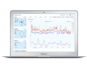
Advances in wind measurement tools are changing how data is collected, analyzed, and used. IoT-connected anemometers now deliver real-time alerts to phones, tablets, or central systems, helping teams react quickly during fast-changing conditions. Some devices use artificial intelligence to study long-term wind behavior and spot patterns that may not be obvious through manual tracking. Remote sensing tools, including satellite-linked sensors and automated loggers, reduce the need for constant on-site checks. These upgrades are making wind data easier to access, more reliable across conditions, and better suited for decision-making across weather, construction, energy, and safety planning.
Conclusion
At Bigfoot Crane, we provide advanced anemometer solutions built to meet the demands of today’s fast-moving environments. Our devices deliver accurate, real-time wind data that supports better planning, stronger safety practices, and improved decision-making across various industries. Construction sites, renewable energy projects, aviation, and farming all benefit from reliable wind monitoring. Contact our team today to find the system that fits your needs and start making smarter, safer decisions with every reading.
