Forecasting weather has always relied on understanding how air moves across land and sea. Without knowing wind speed or direction, early predictions were limited and often inaccurate. The invention of the anemometer gave scientists a tool that brought structure to that missing piece. Measurements could now be recorded, patterns could be tracked, and models could reflect real conditions. What followed shaped everything you need to understand about anemometers. This shift created new confidence in short-range and long-range forecasts. People began to plan around the weather instead of reacting to it. The anemometer helped transform forecasting into a method grounded in observation, data, and repeatable measurements.
Forecasting Before Anemometers
Long before digital models or measuring tools, weather predictions relied on human senses, tradition, and basic instruments. Farmers, sailors, and early scientists studied cloud movement, animal behavior, and shifts in temperature. Wind vanes, which showed the direction of the breeze, were common in villages and ports. Although helpful, they provided no way to measure how fast the wind moved. This meant weather signs could be seen, but not fully explained or shared in a meaningful way.
Why Observation Alone Wasn’t Enough
Judging wind strength by sight or feel often led to mixed results. One person’s strong breeze might feel mild to another, depending on what they were used to or where they stood. Mountains, coastlines, and open fields shaped wind differently, creating large gaps in shared knowledge. Forecasts were limited to local areas, and passing that information across towns or regions was unreliable. Decisions were made using patterns from memory, not numbers. That kind of subjectivity made it hard to build trust or consistency in weather planning.
Missing Numbers, Missing Clarity
It was nearly impossible to form complete weather models without a tool to measure wind speed. Pressure, temperature, and humidity could be noted, but wind remained vague and undefined. Storms would arrive with little warning. Shipping routes stayed risky. Even early warnings for farmers or builders lacked detail. Predicting the arrival or strength of a weather system depended heavily on chance and local stories.
Why Wind Speed Changed Everything
The need to measure wind went beyond curiosity. People needed numbers to compare days, share findings, and improve safety. Wind speed became the missing piece in the broader effort to understand the atmosphere. Once scientists could record and analyze it, forecasting took a step forward that allowed clearer, faster, and far more useful results. The anemometer answered a question the weather had asked for centuries: how fast is the wind actually blowing?
Anemometer Invention and Adoption
Leonardo da Vinci had already started sketching ideas for capturing wind movement long before mechanical tools appeared. His designs showed a deep interest in how air could be observed and measured, though they remained concepts during his time. The science behind measuring wind began with minds like his, where curiosity laid the groundwork for tools that would later turn wind into something measurable and useful.
The Cup Anemometer Breakthrough
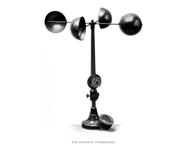
In 1846, Irish physicist John Thomas Romney Robinson introduced a practical solution using four hemispherical cups mounted on arms. As wind pushed the cups, the rotation provided a way to measure speed based on how fast they turned. Simple in design but powerful in function, this became the foundation of the modern cup anemometer. Its ability to give repeatable readings allowed meteorologists to begin capturing wind data with consistency.
Weather Stations Start Recording Wind
As interest in tracking weather patterns grew during the 1800s, early weather stations started adopting these instruments. Measuring wind speed added a new layer to their daily readings, helping connect pressure systems and storm patterns to actual movement in the atmosphere. This step gave researchers a broader view of how weather behaved over time.
Wider Use in National Forecasting
Meteorological offices across Europe and North America began standardizing anemometers as part of their observation tools. Wind data became a shared language among weather stations. These readings made it possible to compare reports from different regions and improve the accuracy of early forecasts. What began as a rotating set of cups became a turning point in how modern weather systems took shape.
Impact on Forecast Accuracy
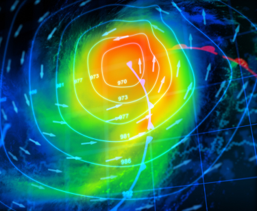
Weather forecasting took a major step forward when scientists could begin measuring wind speed in real time. Before this shift, storm predictions often relied on pressure systems and temperature changes alone. That created large gaps in understanding how fast or where a system might move. Anemometers allowed meteorologists to collect continuous wind speed data as conditions changed. This live information helped identify shifts in direction, acceleration, and pressure boundaries as they developed.
Stronger Storm Predictions Became Possible
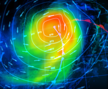
With wind data added into the mix, storm path and intensity models improved significantly. Hurricanes, cyclones, and frontal systems became easier to track as wind movement revealed their structure and energy. Forecasters could warn communities earlier and with better detail. Instead of guessing based on pressure charts or cloud patterns, they could now describe how fast a storm might move and how strong its winds could get. Wind speed became one of the main tools in helping people prepare.
Better Inputs for Weather Models
Global and regional forecasting systems depend on accurate and continuous data. The inclusion of wind measurements gave climate scientists new inputs to fine-tune large-scale models. Ocean winds, upper-air movement, and surface gusts could all be studied with numbers instead of guesswork. These inputs helped simulate temperature changes, rainfall amounts, and pressure zones in a more connected way. The more real data the models used, the more useful the results became.
Long-Term Trends Became Easier to Spot
Beyond short-term predictions, anemometers also helped researchers study patterns over weeks, months, and even years. Repeated measurements over time allowed scientists to map wind behavior across regions and seasons. This created a base of knowledge for understanding climate shifts, seasonal wind events, and changing weather patterns in specific locations. Forecasting grew from a reaction-based process into one built around data, trends, and real wind behavior.
Role in Modern Forecasting Systems
Modern forecasting depends heavily on reliable weather stations, and anemometers play a central role in automated surface observing systems (ASOS). These systems are spread across airports, cities, and rural locations. They constantly measure wind speed and direction along with temperature, pressure, and humidity. Wind data collected from these points updates every minute, feeding live observations into broader national and global weather networks.
Used in Balloons, Satellites, and Drones
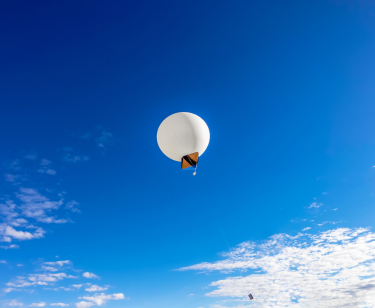
While ground stations handle local tracking, wind measurement has expanded beyond the surface. Weather balloons carry compact anemometers high into the atmosphere. These instruments help track upper-level winds that influence storm development and flight safety. Satellites also use specialized sensors to monitor wind flow across oceans and polar regions. In recent years, unmanned drones equipped with light wind sensors have helped meteorologists gather low-level wind data in areas too dangerous or remote for manned aircraft.
Feeds Data into Global Models
The raw wind data from stations, balloons, satellites, and drones flows directly into global forecasting systems like the Global Forecast System (GFS) and the European Centre for Medium-Range Weather Forecasts (ECMWF). These models process wind, pressure, and temperature measurements together to predict large-scale weather movement. High-quality wind input helps sharpen forecasts for storm strength, rainfall paths, and jet stream behavior. Without this input, global models would lose a key variable.
Supports Public Safety Alerts
Anemometers support public warning systems by offering real-time wind alerts. When wind speeds reach dangerous levels, they trigger automated warnings to aviation control towers, marine crews, and emergency planners. These alerts help stop crane operations, reroute flights, or evacuate boats well before trouble arrives. Local agencies rely on this data to issue wind advisories or hurricane watches. Thanks to constant wind tracking, communities are better informed, and emergency plans become easier to act on with confidence.
Localized Forecasting Applications
Wind Alerts at Airports
Airports rely on short-range wind monitoring to guide daily operations. Strong gusts, crosswinds, or sudden shifts in wind direction can affect aircraft during takeoff and landing. Ground crews use anemometer data to adjust flight paths, delay departures, or redirect incoming traffic. This kind of precision improves runway safety and protects both passengers and flight crews.
Wind Guidance for Farms
In agriculture, wind data helps farmers time spraying, irrigation, and planting. Spraying pesticides or fertilizers during strong winds can waste resources and harm nearby crops, animals, or homes. Anemometers give farmers a reliable view of wind direction and speed, allowing them to work more efficiently and avoid accidental drift. These small decisions protect harvests and reduce costs.
Safer Construction Sites
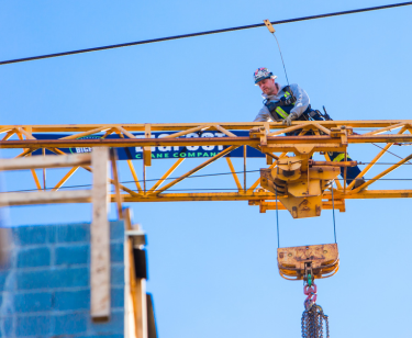
Construction work at height often depends on stable wind conditions. On cranes, scaffolds, and exposed floors, high winds increase the chance of falls, dropped materials, and structural damage. Anemometers installed on-site offer real-time updates that help supervisors decide when to pause lifting or adjust schedules. These alerts prevent injuries and damage, especially on tall buildings or bridges.
Coastal and Marine Warnings
In coastal areas, wind forecasting helps protect lives and property. Sudden wind shifts may signal an approaching storm or rising tide. Local fishers, port operators, and ferry services monitor wind to avoid setting out during unsafe conditions. Real-time updates support early action, from moving boats to closing beaches or issuing advisories.
Future Outlook
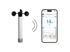
Anemometers are becoming smarter through integration with IoT platforms and AI-based forecasting systems. These advancements allow them to communicate with broader networks, offering better predictions and quicker responses. Their role continues to grow beyond short-term forecasting. Researchers now use wind data to study long-term climate patterns, monitor atmospheric changes, and support environmental modeling. As weather events become less predictable, connected anemometers will remain key tools in helping both local teams and global scientists prepare more effectively.
Conclusion
Wind monitoring will remain a steady part of how people understand and respond to atmospheric changes, both locally and globally. From daily operations to long-term planning, accurate wind data supports smarter decisions and safer outcomes. If your work depends on precision and reliability, Bigfoot Crane is here to support you. Our team offers dependable, real-time anemometer solutions built for demanding environments. Contact us today to find the right anemometers for your needs and move forward with confidence.
